
The Benefits of GIS Automated Systems in Local and State Urban Planning
Automation is a key concern in the construction and architectural sectors. Some believe more artificial intelligence means fewer jobs. However, automation actually offers an array of benefits.
The rise of artificial intelligence has changed the landscape. Architects and engineers now have more data than ever at their fingertips. Instead of going through it manually, they can rely on software to do it for them. The same goes for other construction-related sectors.
Automation comes with several benefits. It makes you more efficient. You spend less time going through data, so you can focus your efforts on other areas. Artificial intelligence also reduces the risk of errors. This leads to safer structures and more satisfied customers.
Even so, some fear the trend towards automation. There’s a belief that automation will result in job losses throughout the sector. This isn’t a concern restricted to the construction fields. Automation affects jobs in almost every industry. However, those in skilled positions tend to use automation to their advantage. Being replaced isn't usually an issue for them.
This brings us to the subject of this article – city planning. City planners take responsibility for ensuring a nation’s cities work. They must take everything from road and building layouts to utilities into account. To do this, they use Geographic Information Systems (GIS) heavily in their work. These systems have helped planners make crucial decisions for many years. However, these tools are also not immune to the rising tide of automation. As GIS software becomes more complex, automation becomes a factor.
Is this a good thing? Let’s find out.
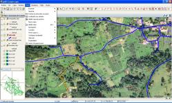
What is a Geographic Information System
Geographic Information Systems have existed for centuries. They also play a crucial role in the lives of average people. However, many don’t even know that they exist. They also don’t see how a GIS affects the way they live.
On a basic level, GIS software captures geographic and social data. More advanced software packages can analyse this data. City planners use the systems to determine how geographic and social issues affect their cities. The aim is to create an organised city that allows residents to live their lives comfortably.
A GIS also assesses a community’s needs. These include basic living requirements, such as shelter and utilities. A city's infrastructure and services are also included. City planners can also use GIS software to ensure a city delivers its services effectively.
Take health services as an example. GIS can reveal connections between public health and geographic location. A great example of this occurred in the 1800s. At the time, London, England, was in the throes of a cholera epidemic. The disease was rampant, but nobody could locate its source.
Noted physician John Snow took control of the problem. Using a map of London, he marked the areas where cholera had broken out. Using this information, coupled with his patient knowledge, he identified the source. His work led to the end of the outbreak.
While he didn’t have software at his disposal, Snow still used a primitive form of GIS. Modern systems still do similar work. They identify spatial patterns and link them to geographic issues.
As a result, city planners use GIS software to create good cities.
The Benefits of Automated Geographic Information Systems
As you can see, Geographic Information Systems existed long before automation. However, cities are now more complex than they’ve ever been. Snow’s methods from over one hundred years ago would not work today. Cities have far too many moving parts for manual examination.
As computer software and cities evolve, automation has become key in GIS. The benefits extend wider than basic planning. These are just a few:
Benefit #1 – Lower Costs
Cost is a key concern for all city planners. GIS systems improve decision making, which drives down costs. You won’t have to account for mistakes made during the design process, as the system should highlight them for you.
This is also where automation comes into play. Automated systems allow you to dedicate less of your time to handling data. You simply input the relevant figures and allow the system to handle the calculations for you.
GIS systems have a direct effect on the number of hours your design takes to create. That saved time can go towards other areas of the project. It also means you produce fast designs that cost less money for your clients.
Benefit #2 – Accounting for Population Growth
As time goes on, cities experience fluctuations in population levels. Increases lead to more demand for services, utilities, and housing stock. Poorly-prepared planners can’t account for this. However, GIS automated systems can take in data from various sources to predict population changes.
This is particularly important in modern Australia. The country’s population has risen between 0.6% and 3.4% each year since 1960. Since 2010, that figure has hovered around the 1.5% mark.
There’s also plenty of data that anticipates population growth in the future. According to .id, Sydney’s population will grow by over 1.5 million people between 2017 and 2040.
City planners must account for this. They build increasingly efficient cities to adapt to population changes. They must ensure that there is enough housing stock, and that people have access to services.
GIS automated systems can take such data and create models based on it. This helps city planners to anticipate population changes and their effects on current city plans. As a result, automation can help you to prepare for the changes.
Benefit #3 – Adapting to Demographic Changes
In addition to population growth, the people in cities change in several ways. For example, commercial development in a city may lead to an influx of young professionals. These people need different services than families or senior citizens. On top of that, more businesses mean more people. Cities need adequate public transport to ensure people get to work. All of this falls under the remit of city planners.
That’s just one example of how a city’s demographic may change over time. City plans must adjust to the type of people living in the city, as well as the amount. Automation allows you to track demographic trends and anticipate what’s coming in the future. Again, you could do this manually. However, that means spending more time on research. The more time you spend researching, the less time you have to make adjustments.
Benefit #4 – Figuring Out Multilayer Maps

If you’ve used GIS software before, you’re likely familiar with multilayer maps. Each layer of these maps accounts for a different aspect of the city. For example, one layer may highlight agricultural land. Another may pinpoint areas at risk of flood or bushfires. Yet other layers may mark out prime territory for commercial or residential development. Each of these layers affects the city’s residents and developers. For example, an area that’s prone to bushfires leads to higher insurance premiums for residents. Builders also have to take more regulations into account. These are things that city planners need to know before approving construction projects.
Each layer also has its own data and information linked to it. This is where automation really helps city planners. Instead of having to go through the data in each layer of the map, you can draw conclusions using automation. For example, an automated system can inform you of the risks associated with building in particular areas. It will examine every layer of the map, and won’t miss potential issues. You can’t say the same for going through the map layers manually. Human error could lead to bad situations.
Benefit #5 – Faster and More Accurate Results
Speaking of human error, accuracy is key in city planning. Even the smallest of mistakes can snowball into major issues.
Think of all of the opportunities for mistakes that manual planning presents. You could read data incorrectly, or make a mistake in calculations. Every manual task you undertake in a regular GIS software package creates room for error. As the work becomes more complex, the possibility of mistakes multiplies. Furthermore, you’ll often repeat simple tasks over and over as part of your work. This leads to fatigue, which results in more mistakes.
Automation eliminates many of these errors. Assuming the accuracy of the parameters you define for a task, automation produces accurate results based on the data. Human error is no longer an issue. As a result, city planners have to deal with fewer avoidable problems.
This capacity for handling error does not come with a loss of speed. In fact, greater efficiency is also a key benefit of GIS automated systems. Consider the most repetitive task you currently undertake with your GIS software. Each repetition of the task requires manually moving a cursor and clicking. It may only take a few seconds. However, when done hundreds or thousands of times, those seconds add up. Automation gets rid of these small manual steps. As a result, you save time in areas where you may not have realised there is time to save.
Additional Benefits
Those are just some examples of the benefits that come with GIS automated systems. Specific benefits may differ depending on the city planner’s needs. However, the key is that automation provides more accurate results faster.
This extends to whatever you need to learn about the city you work with. Whether it’s infrastructure, population, or services, automation improves what you deliver.
What Do City Planners Think?
Despite these benefits, some city planners believe that automation offers cause for concern. The web hosts plenty of articles talking about how automation places jobs at risk.
But is this really the case for city planners?
The truth is that it’s unlikely that automation will cause planners to lose their jobs. However, that isn’t to say that planners shouldn’t make adjustments. In an increasingly technological world, the failure to adapt may lead to obsolescence.
Some may argue that automation leads to standardisation in planning. This results in job losses. However, that’s not the case. Automation is actually a way for planners to offer better results than they have before. It allows for the creation of faster and more accurate solutions.
This helps in other ways too. City planners must deal with more than technological changes in their work. For example, the changing whims of a local government may have more effect on a planner than technology. Budget cuts present as much of a threat to jobs as anything else. Automation may help planners make themselves invaluable. If you can use it to prove you can deliver on a lower budget, you reinforce your position.
In this context, automation and artificial intelligence aren’t threats to your job. In fact, they could be the best way for city planners to adapt to budgetary changes that would challenge their roles.
Of course, that doesn’t mean you should assume that everything stays the same. Automation requires adaptation. If you can’t meet the demands of changing technologies, you may be at risk. However, that’s the same as in any other industry. Those who keep learning to make themselves valuable. As a result, embracing automation is key to a secure future in city planning.
Conclusion
Automation is here to stay. You can see it in everything from digital design software to GIS software. It’s how you adapt to the march of automation that will determine your success in the future.
New technologies pave the way for greater accuracy and efficiency. They can help you to plan better cities, making them a tool in your arsenal rather than a challenge to your role. Through automation, you can make decisions based on accurate data. You also cut out many of the repetitive tasks that divert your focus away from key issues.
So, what do you do if you have no experience with automated GIS software? That’s where ArchiStar Academy can help. We offer the ArchiStar Property platform. This allows you to generate rapid feasibility reports that help with city planning.
We can help you to learn everything you need to know to use the software. In doing so, you’ll adapt and benefit from the rise of automation in the city planning sector. Contact ArchiStar to find out more today.
ArchiStar Academy offers several courses across the spectrum of digital design software. You’ll develop your skills, allowing you to create more accurate and functional models.
Please don’t hesitate to get in touch with Archistar Academy today if you have any questions.
If you would like to share your thoughts on our blog, we’d love to hear from you!
Get in touch with the ArchiStar Academy community via Facebook.
Posted on 20 Jan 2020